 |
 |
 |
 |
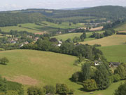
Look up to the east from downtown Hope Mansell and you see a line of trees along the hill – the edge of the forest. The boundary line seems clear – but there’s a story to why it lies where it now does.
More than trees, a forest is land set aside for hunting – foraging – originally reserved for the King, and the Forest of Dean was already a royal forest in Saxon times. After the conquest, the Norman Kings claimed more and more land until, by 1200, nearly a third of England was designated forest. Land in which nobody else was allowed to hunt, forage or – mostly – even to live. Most people know of the Magna Carta of 1215, in which the barons set limits to the King’s power. Fewer have heard of the 1217 Charter of the Forest, which was arguably more important, since, revolutionary though Magna Carta was, it was very much an upper-class affair. It was the barons whose rights were guaranteed.
The Charter of the Forest limited the area of royal forest and set out the rights of ordinary people. Freemen living in the forest were allowed to cut wood and grow crops, to fish, build houses and mills, dig ditches and so on, provided they did no harm to others. The death penalty for killing deer was abolished – though fines were not. The rights of the foresters in the Forest of Dean are drawn from this charter, which was not replaced by other legislation until the 1970s.
At the time of the charter, the Forest of Dean covered all the land between the Severn and the Wye, with a northern limit running roughly from Ross, through Newent, to Gloucester. In 1833, the boundaries of the forest were redrawn, and set more or less where they are now, with boundary stones set around the edges of the so-called “statutory forest”. The bounds of the forest are independent of local government boundaries, so parts of the parish of Hope Mansell – Dancing Green to Bailey Lane End – are in the forest even though all of the parish is in Herefordshire.
In 1996 Forest Warden Glynn Bullock began a project to find all 225 of the 1833 boundary stones. Some were found in surprising places. There’s one on the edge of a field above Kettle Bottom. Another (number 151) is built into the garden wall of Moat Farm. It would be interesting to know of others in our area – especially if they’re among the 55 still missing, two each of which were in Dancing Green and Bailey Brook. Let us know through wstnnews@yahoo.co.uk.
Ian Lewis